Table of Contents
ToggleUnderstanding the Fundamentals
What is a Landform?
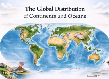
A landform is a small to medium-sized part of the Earth’s surface. Several related landforms together make up a landscape.
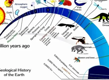
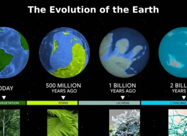
The Concept of Evolution
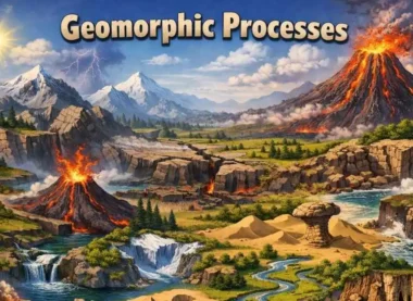
Landforms are not permanent. They undergo a process of change—from youth to maturity and finally old age. This cycle of change is known as the geomorphic cycle.
- Geomorphic Agents: These are mobile mediums like running water, groundwater, glaciers, wind, and waves which remove, transport, and deposit earth materials.
- Geomorphic Processes: These include erosion and deposition.
Running Water: The Most Significant Geomorphic Agent
In humid regions, running water is the most important factor in landform evolution. It operates in two components: overland flow (on the general land surface as a sheet) and linear flow (as streams and rivers in valleys).
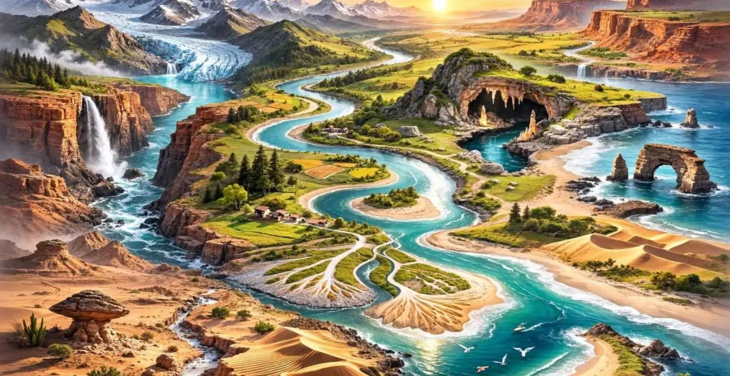
Erosional Landforms by Running Water
- Valleys: These start as small rills, which deepen into gullies, then further into V-shaped valleys, gorges, and canyons.
- Gorge: A deep valley with very steep to straight sides (e.g., Indus Gorge).
- Canyon: Characterized by steep step-like side slopes and is often wider at the top than at the bottom (e.g., Grand Canyon).
2. Potholes and Plunge Pools: Small more or less circular depressions formed in the rocky beds of hill streams due to abrasion. A large pothole at the base of a waterfall is called a plunge pool.
3. Incision or Entrenched Meanders: In streams that flow over steep gradients, erosion is concentrated on the bottom of the stream channel.
4. River Terraces: Surfaces marking old valley floor or floodplain levels. They represent upliftment or a change in the river’s base level.
Depositional Landforms by Running Water
Alluvial Fans: Formed when streams flowing from higher levels break into foot slope plains. The load is dropped as a broad low cone-shaped deposit.
Deltas: Similar to alluvial fans but formed at the mouth of the river. The load is distributed into several channels called distributaries.
Floodplains, Natural Levees, and Point Bars:
- Natural Levees are found along the banks of large rivers.
- Point Bars (meander bars) occur on the concave side of meanders.
Meanders: These are loop-like channel patterns. Ox-bow lakes are formed when a meander is cut off from the main river.
Groundwater: Karst Topography
Groundwater acts as a geomorphic agent primarily through chemical weathering (solution and precipitation) in rocks like limestone or dolomites rich in calcium carbonate. This creates Karst Topography.
Erosional Karst Landforms
- Swallow Holes and Sinkholes: Circular depressions where surface water disappears underground.
- Lapiés: Grooved and fluted surfaces formed by the solution of limestone.
- Caves: Formed where there are alternating beds of rocks (shale, sandstone, quartzite) with limestones or dolomites in between.
Depositional Karst Landforms
- Stalactites: Calcium carbonate deposits hanging from the ceiling of a cave.
- Stalagmites: Deposits rising from the floor of the cave.
- Pillars: Formed when a stalactite and stalagmite join together.
Glaciers: The Power of Ice
Glaciers are masses of ice moving as sheets (continental glaciers) or linear flows (mountain/valley glaciers) due to gravity.
Erosional Glacial Landforms
- Cirque: A deep, long, and wide trough or basin with very steep concave to vertically dropping high walls at its head.
- Horns and Serrated Ridges: Horns (e.g., Matterhorn) form when three or more radiating glaciers cut headward until their cirques meet.
- Glacial Valleys/Troughs: Characterized by U-shaped valleys with relatively flat floors and steep sides. Fiords are deep glacial troughs filled with seawater.
Depositional Glacial Landforms
- Moraines: Accumulations of glacial debris (till). They can be terminal, lateral, or ground moraines.
- Eskers: Ridges made of sands and gravels deposited by meltwater flowing through ice tunnels.
- Drumlins: Smooth oval-shaped ridge-like features composed mainly of glacial till; they look like inverted spoons and indicate the direction of glacier movement.
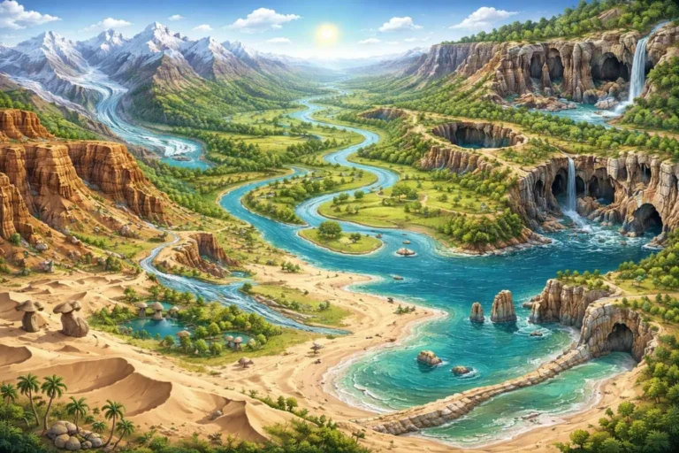
Waves and Currents: Coastal Landforms
Coastal processes are dynamic, driven by waves, currents, and tides.
Erosional Coastal Landforms
Cliffs, Terraces, Caves, and Stacks: Wave-cut platforms occur where sea cliffs are eroded. Sea Stacks are isolated rock masses left standing in the sea after the surrounding rock has been eroded.
Depositional Coastal Landforms
- Beaches and Dunes: Beaches are temporary accumulations of sand and shingle.
- Bars, Barriers, and Spits: Ridges of sand/shingle formed in the sea off the coast. If a bar joins two headlands, it is a spit or tombolo.
Winds: Arid and Semi-Arid Landforms
In deserts, wind is a significant agent, but flash floods (water) also play a major role.
Erosional Arid Landforms
- Pediments and Pediplains: Gently inclined rocky floors at the base of mountains.
- Mushroom Rocks: Rocks with a broad upper part and a narrow base, formed due to greater wind abrasion near the ground.
- Inselsbergs: Isolated residual hills rising abruptly from a level circuit.
Depositional Arid Landforms
Sand Dunes: Various types including Barchans (crescent-shaped), Seifs (longitudinal), and Transverse dunes.
Loess: Fine loam/silt deposited by wind over vast areas far from the source.
UPSC Prelims: PYQs & Practice Questions
Previous Year Questions (PYQs)
Question 1 (2010)
Q: What is the correct sequence of the following topographical features found from upper reaches to lower reaches of a river?
1. Ox-bow Lake
2. Rapids
3. Flood Plains
Select the correct answer:
(a) 1-2-3
(b) 2-1-3
(c) 3-1-2
(d) 2-3-1
Answer: (d) 2-3-1
Explanation: In the Youthful stage (upper reaches), a river forms Rapids and V-shaped valleys due to dominant vertical erosion. In the Mature stage (middle course), lateral erosion leads to the development of Flood Plains. In the Old stage (lower reaches), extensive meandering results in the formation of Ox-bow Lakes.
Question 2 (2014)
Q: Which of the following phenomena might have influenced the evolution of organisms?
1. Continental Drift
2. Glacial cycles
Select the correct answer:
(a) 1 only
(b) 2 only
(c) Both 1 and 2
(d) Neither 1 nor 2
Answer: (c) Both 1 and 2
Explanation: Continental Drift separated species geographically, leading to divergent evolution and speciation. Glacial cycles (Ice Ages) caused climatic shifts that forced migrations, adaptations, and extinctions, significantly influencing the evolution of both landforms and life forms.
Practice Questions (Prelims)
Question 1
Q: Consider the following pairs of Landforms and their Geomorphic Agents:
1. Cirque : Glaciers
2. Stalagmites : Groundwater
3. Barchans : Wind
4. Natural Levees : Running Water
How many of the above pairs are correctly matched?
(a) Only one pair
(b) Only two pairs
(c) Only three pairs
(d) All four pairs
Answer: (d) All four pairs
Explanation: Cirques are erosional landforms created by glacial action. Stalagmites are depositional karst landforms formed by groundwater activity in limestone caves. Barchans are crescent-shaped sand dunes formed by wind in arid regions. Natural levees are depositional features formed by rivers during floods.
Question 2
Q: Which of the following features are indicative of the "Youthful" stage of a river?
1. V-shaped Valleys
2. Gorges
3. Meanders
4. Plunge Pools
(a) 1, 2, and 3 only
(b) 1, 2, and 4 only
(c) 2 and 4 only
(d) 1, 2, 3, and 4
Answer: (b) 1, 2, and 4 only
Explanation: V-shaped valleys, gorges, and plunge pools are typical of the youthful stage where vertical erosion dominates. Meanders are characteristic of the mature and old stages of a river, where lateral erosion becomes dominant.
UPSC Mains – Previous Year & Practice Questions
Previous Year Questions (Mains)
Indonesian & Philippines Archipelagos (2014)
Question: Explain the formation of thousands of islands in Indonesian and Philippines archipelagos. (2014)
Concept: Convergent plate boundaries and volcanic island arc evolution.
Gorge vs Canyon
Question: Differentiate between a 'Gorge' and a 'Canyon'. Give examples of each.
Concept: Vertical erosion by rivers under different climatic conditions — Gorges in humid regions; Canyons in arid and semi-arid regions.
Continental Drift Theory (2013)
Question: What do you understand by the theory of 'Continental Drift'? Discuss the prominent evidences in its support. (2013)
Concept: Alfred Wegener's theory explaining landform distribution and continental movement.
Glacial Erosional Landforms
Question: Discuss the various types of glacial erosional landforms and their characteristics.
Concept: Cirques, Horns, Arêtes, and U-shaped valleys formed due to glacial erosion.
Karst Topography Evolution
Question: Describe the evolution of Karst topography and the conditions necessary for its development.
Concept: Chemical weathering of limestone in regions with adequate rainfall, soluble rocks, and well-developed joints.
Mains Practice Questions
Makran Subduction Zone & West Coast Vulnerability
Question: Analyze the vulnerability of India’s West Coast to tsunamis originating from the Makran Subduction Zone. (250 words)
Coastal Regulation Zone (CRZ) Norms
Question: "Coastal Regulation Zone (CRZ) norms are the first line of defense against oceanic disasters." Critically examine. (250 words)
Shoaling Effect & Deep-Sea Tsunami Dynamics
Question: Examine the 'Shoaling Effect' and explain why deep-sea vessels often remain unaware of a tsunami passing beneath them. (150 words)
Landforms and Their Evolution: Landscape Development - FAQs
What is the difference between a V-shaped valley and a U-shaped valley?
- V-shaped valleys are formed by the vertical erosion of running water (rivers) in their youthful stage.
- U-shaped valleys (Glacial Troughs) are formed by the powerful “plucking” and “abrasion” of glaciers, which widen and flatten the valley floor.
What are 'Potholes' in a river bed?
They are circular depressions formed in the rocky bed of mountain streams. They are caused by the abrasive action of pebbles and rocks being whirled around by turbulent water flow.
How does a 'Mushroom Rock' get its shape?
In deserts, wind-borne sand erodes rocks. Because the wind carries more sand at lower heights (due to gravity), the abrasion is more intense at the base of the rock than at the top, resulting in a narrow pillar and a broad top.
What is 'Rejuvenation' in landform evolution?
Rejuvenation occurs when a landscape that has reached “old age” is uplifted by endogenic forces (earth movements) or a drop in sea level. This gives the river “new life” or energy to start vertical downcutting again, creating features like entrenched meanders.
What are 'Drumlins' often called?
They are often referred to as the “Basket of Eggs Topography” because of their oval, mound-like appearance when found in clusters, resembling eggs in a basket.