Table of Contents
ToggleThe earth’s atmosphere is in a state of constant motion. This movement is driven by the unequal heating of the earth’s surface, creating pressure differences that force air to move from high to low pressure. This motion, known as Atmospheric Circulation, redistributes heat across the globe and dictates the world’s weather systems.
Atmospheric Pressure and Winds
The Concept of Air Pressure
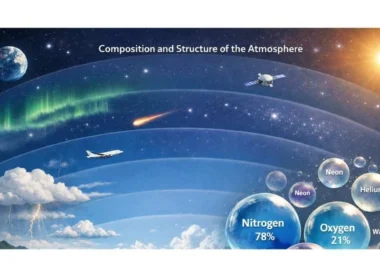
The weight of a column of air contained in a unit area from mean sea level to the top of the atmosphere is called Atmospheric Pressure. It is measured in millibars (mb) or Pascals.
- Vertical Variation: Pressure decreases rapidly with height. At sea level, the average pressure is 1013.2 mb.
- Horizontal Variation: Small differences in horizontal pressure are highly significant in terms of wind direction and velocity.
Factors Affecting Wind Direction and Velocity
- Pressure Gradient Force (PGF): The rate of change of pressure with respect to distance. The force is perpendicular to the isobars (lines of equal pressure).
- Frictional Force: Affects speed and direction within 1-3 km of the surface. It is greatest over irregular land and minimal over smooth ocean surfaces.
- Coriolis Force: An apparent force caused by Earth’s rotation. It deflects winds to the right in the Northern Hemisphere and to the left in the Southern Hemisphere.
- It is zero at the Equator and maximum at the Poles.
- This force is why tropical cyclones do not form at the Equator.
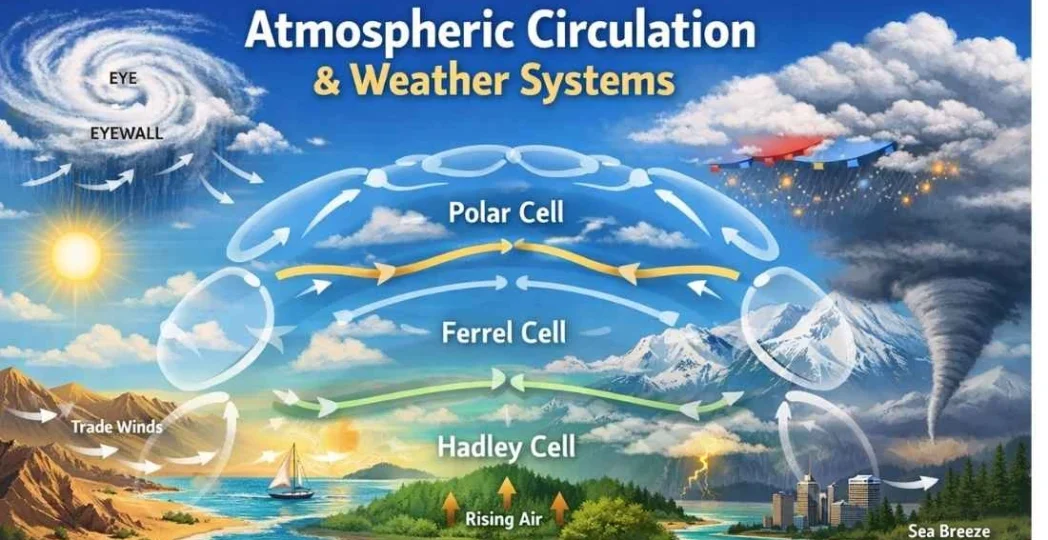
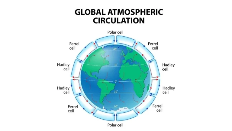
General Circulation of the Atmosphere
The pattern of planetary winds depends on the distribution of land and water, the rotation of the earth, and the migration of the sun. This creates three distinct cells in each hemisphere.
A. The Hadley Cell
Located between the Equator and 30° latitudes.
- Air rises at the Inter-Tropical Convergence Zone (ITCZ) due to high insolation.
- It moves toward the poles in the upper atmosphere and sinks at 30° N and S, creating the Sub-tropical High-Pressure Belts (Horse Latitudes).
B. The Ferrel Cell
Located between 30° and 60° latitudes.
- The sinking air at 30° flows toward the poles as Westerlies.
- At 60°, it meets cold air from the poles and is forced to rise.
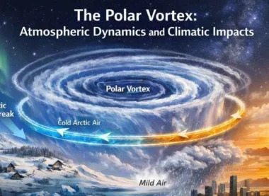
C. The Polar Cell
Located between 60° and the Poles.
- Cold, dense air at the poles sinks and flows toward the mid-latitudes as Polar Easterlies.
Planetary Winds and Local Winds
Major Wind Belts
- Trade Winds: Steady winds blowing from the sub-tropical high toward the equatorial low (ITCZ).
- Westerlies: Winds blowing from sub-tropical high to sub-polar low. They are strongest in the Southern Hemisphere (called Roaring Forties, Furious Fifties, and Shrieking Sixties).
- Polar Easterlies: Cold winds blowing from polar high to sub-polar low.
Seasonal and Local Winds
- Monsoons: Large-scale seasonal reversals of wind direction.
- Land and Sea Breezes: Daily cycles driven by differential heating of land and water.
- Mountain and Valley Breezes: Driven by slope heating.
- Local Named Winds:
- Loo: Hot, dry wind in Northern India.
- Mistral: Cold wind from the Alps toward the Mediterranean.
- Chinook (Snow Eater): Warm, dry wind on the leeward side of the Rockies.
Air Masses and Fronts
Air Masses
An Air Mass is a large body of air having little horizontal variation in temperature and moisture.
- Source Regions: The vast areas over which air masses form (e.g., Tropical Oceans, Polar Ice Caps).
- Classifications: Maritime Tropical (mT), Continental Tropical (cT), Maritime Polar (mP), Continental Polar (cP), and Continental Arctic (cA).
Fronts
When two different air masses meet, the boundary zone between them is called a Front.
Cold Front: Cold air moves toward warm air. Characterized by narrow zones of intense rainfall and thunderstorms.
Warm Front: Warm air moves toward cold air. Characterized by gradual rising and light, prolonged rain.
Stationary Front: Neither air mass moves.
Occluded Front: When an air mass is lifted completely off the ground.
Tropical and Extra-Tropical Cyclones
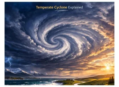
Extra-Tropical (Temperate) Cyclones
- Form in the mid-latitudes (35°-65°) where warm and cold air masses meet.
- Driven by frontogenesis (front formation).
- They move from West to East (with the Westerlies) and can cover vast areas.
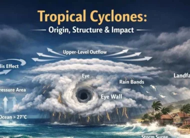
Tropical Cyclones
Violent storms that originate over tropical oceans.
- Conditions for Formation:
- Large sea surface with temperature > 27°C.
- Presence of Coriolis Force.
- Small variations in vertical wind speed.
- Pre-existing weak low-pressure area.
- Structure: The center is the Eye (calm, low pressure), surrounded by the Eye Wall (highest winds/rain).
- Names: Cyclones (Indian Ocean), Hurricanes (Atlantic), Typhoons (Western Pacific), Willy-Willies (Western Australia).
Thunderstorms and Tornadoes
- Thunderstorms: Localized storms caused by intense convection. If the clouds reach the freezing level, hail may form.
- Tornadoes: Violently rotating columns of air extending from a thunderstorm to the ground. Over the sea, they are called waterspouts.
UPSC Prelims: PYQs & Practice Questions
Previous Year Questions (PYQs)
Question 1 (2014)
Q: The seasonal reversal of winds is the typical characteristic of:
(a) Equatorial climate
(b) Mediterranean climate
(c) Monsoon climate
(d) All of the above
Answer: (c) Monsoon climate
Explanation: The term 'Monsoon' is derived from the Arabic word 'Mausim', meaning season. It refers to a seasonal reversal in wind direction, primarily driven by the differential heating of land and water. This reversal is the defining feature of the Monsoon climate system.
Question 2 (Generic UPSC Theme)
Q: What is the phenomenon that causes the deflection of winds to the right in the Northern Hemisphere and to the left in the Southern Hemisphere?
(a) Centrifugal Force
(b) Pressure Gradient Force
(c) Coriolis Force
(d) Magnetic Force
Answer: (c) Coriolis Force
Explanation: Caused by the Earth's rotation, the Coriolis Force acts perpendicular to the pressure gradient force. It deflects winds to the right in the Northern Hemisphere and to the left in the Southern Hemisphere. The Coriolis effect is zero at the equator and increases towards the poles.
Practice Questions (Prelims)
Question 1
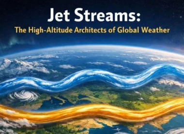
Q: Consider the following statements regarding 'Jet Streams':
1. They are narrow bands of high-speed winds in the upper troposphere.
2. They generally move from West to East in both hemispheres.
3. Their path is straight and unaffected by temperature gradients.
Which of the statements given above are correct?
(a) 1 and 2 only
(b) 2 and 3 only
(c) 1 and 3 only
(d) 1, 2, and 3
Answer: (a) 1 and 2 only
Explanation: Statement 3 is incorrect because Jet Streams follow a meandering path (Rossby Waves) and are strongly influenced by the temperature gradient between the poles and the equator.
Question 2
Q: With reference to 'Tropical Cyclones', consider the following:
1. The center of the cyclone is a region of high pressure called the 'Eye'.
2. They gain energy from the latent heat of condensation.
3. They dissipate upon reaching land (landfall).
Which of the statements given above is/are correct?
(a) 1 and 2 only
(b) 2 and 3 only
(c) 3 only
(d) 1, 2, and 3
Answer: (b) 2 and 3 only
Explanation: Statement 1 is incorrect because the Eye is a region of extremely low pressure and calm air, not high pressure. Tropical cyclones draw energy from latent heat release and weaken rapidly after landfall due to loss of moisture supply and increased friction.
Previous Year Questions (Mains)
Tropical Cyclones: Regional Concentration (2014)
Question: “Tropical cyclones are largely confined to the South China Sea, Bay of Bengal and Gulf of Mexico. Why?” (2014)
Focus: Discuss the requirements of high sea surface temperature (>27°C) and the presence of the Coriolis Force.
Air Masses & Macro-Climatic Changes (2016)
Question: “Discuss the concept of air mass and explain its role in macro-climatic changes.” (2016)
Focus: Define Air Masses, their source regions, and how their movement creates Fronts.
Jet Stream & Indian Monsoon (Theme)
Question: “How does the jet stream influence the Indian Monsoon?” (General Theme)
Focus: Role of the Sub-tropical Westerly Jet and the Tropical Easterly Jet in the burst of the monsoon.
Frontogenesis & Cold Front Weather (Theme)
Question: “Explain the mechanism of ‘Frontogenesis’ and the weather associated with a Cold Front.” (General Theme)
Focus: Meeting of cold and warm air masses and the resulting cumulonimbus clouds and heavy rain.
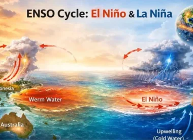
Walker Circulation & El Niño (Theme)
Question: “What is ‘Walker Circulation’ and how does it relate to El Niño?” (General Theme)
Focus: East-west circulation in the Pacific and its reversal during ENSO events.
Mains Practice Questions
Planetary Winds & Major Hot Deserts
Question: “Account for the planetary wind system of the world. How do these winds influence the location of the world's major hot deserts?”
Tropical vs Extra-tropical Cyclones
Question: “Compare and contrast Tropical Cyclones and Extra-tropical (Temperate) Cyclones in terms of their origin, energy source, and movement.”
Climate Change & Atmospheric Rivers
Question: “Discuss the impact of Climate Change on the frequency and intensity of ‘Atmospheric Rivers’ and their consequences on global weather.”
Atmospheric Circulation & Weather Systems- FAQs
Why is there no cyclone at the Equator?
The Coriolis Force is zero at the equator. Without this force, the air flows directly into the low-pressure center rather than rotating around it, preventing the formation of a vortex.
What are 'Roaring Forties' and 'Furious Fifties'?
These are the Westerlies in the Southern Hemisphere (at 40° and 50° latitudes). Because there is very little landmass to cause friction, these winds reach extremely high and consistent speeds.
What is the 'ITCZ'?
The Inter-Tropical Convergence Zone is a low-pressure belt near the equator where the Trade Winds from the Northern and Southern Hemispheres meet (converge), causing air to rise and form heavy convectional rainfall.
What is a 'Geostrophic Wind'?
When the Pressure Gradient Force is exactly balanced by the Coriolis Force, the wind blows parallel to the isobars rather than across them. This usually occurs in the upper atmosphere where friction is negligible.
What is 'Adiabatic' cooling/heating?
It is the change in temperature of a parcel of air due to change in pressure, without any exchange of heat with the surrounding environment. Rising air expands and cools; sinking air compresses and warms.