Table of Contents
ToggleIndia–Japan Defence Cooperation: From Strategic Partnership to Operational Security Partnership
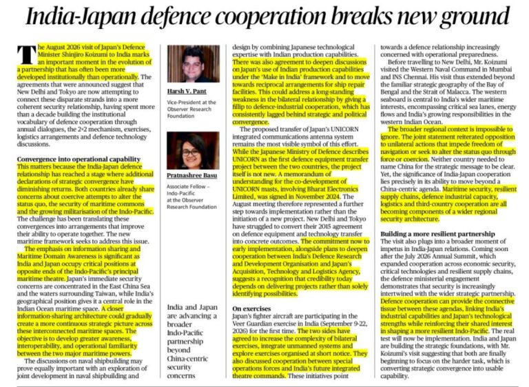
The India–Japan defence partnership has entered a new phase, moving beyond diplomatic commitments towards stronger operational cooperation. The August 2026 visit of Japan’s Defence Minister highlighted the growing convergence between the two countries in areas such as maritime security, defence technology, information sharing and joint military exercises.
The partnership has gained importance amid increasing security challenges in the Indo-Pacific region and the need to maintain a free, open and rules-based regional order.
From Strategic Convergence to Operational Cooperation
For more than a decade, India and Japan have built institutional mechanisms through:
- Annual defence dialogues
- 2+2 ministerial meetings
- Military exercises
- Logistics cooperation
- Defence technology discussions
The current focus is shifting towards improving the ability of both countries to operate together effectively through practical cooperation and capability building.
Strengthening Maritime Security and Maritime Domain Awareness
Maritime security is a major pillar of India–Japan defence cooperation.
Both countries are focusing on:
- Maritime Domain Awareness (MDA)
- Information sharing
- Monitoring activities in critical sea routes
- Enhancing naval interoperability
India’s position in the Indian Ocean and Japan’s strategic location in the Western Pacific make cooperation between the two countries important for maintaining regional maritime stability.
Defence Technology and Industrial Cooperation
Defence-industrial cooperation has become a key area of partnership.
India and Japan are working towards:
- Technology transfer
- Joint defence production
- Defence equipment cooperation
- Research and development collaboration
The cooperation under the “Make in India” framework aims to combine Japanese technological expertise with India’s manufacturing capabilities.
Projects such as the transfer of defence-related technologies and communication systems indicate a shift from discussions towards implementation.
Joint Military Exercises and Interoperability
Regular military exercises are strengthening operational coordination between the armed forces of both countries.
These exercises focus on:
- Improving interoperability
- Sharing operational experiences
- Enhancing coordination in humanitarian assistance and disaster relief operations
- Strengthening maritime and defence preparedness
Interoperability refers to the ability of military forces to work together effectively during joint operations.
Importance for Indo-Pacific Security
India–Japan defence cooperation contributes to:
- A stable Indo-Pacific region
- Secure maritime routes
- Resilient supply chains
- Greater regional coordination
The partnership also supports broader cooperation among like-minded countries seeking a rules-based international order.
Challenges and Way Forward
Despite strong strategic convergence, challenges remain in ensuring faster implementation of defence projects, expanding industrial collaboration and improving technological cooperation.
Future cooperation should focus on converting strategic understanding into practical capabilities through deeper defence production, innovation and operational coordination.
Conclusion
India–Japan defence cooperation is evolving into a practical security partnership based on maritime security, defence technology, information sharing and military interoperability. As regional challenges increase, stronger India–Japan cooperation will play a crucial role in building a secure and resilient Indo-Pacific.
Vocabulary
1. Interoperability – Ability of forces to work together
2. Maritime Domain Awareness – Monitoring and understanding activities at sea
3. Defence Industrial Cooperation – Joint defence production and technology sharing
Prelims MCQs
MCQ 1
Consider the following statements:
1. India and Japan are members of the QUAD grouping.
2. Malabar exercise includes India and Japan.
3. Defence cooperation between India and Japan focuses only on land-based security.
Which are correct?
A) 1 and 2 only
B) 2 and 3 only
C) 1 and 3 only
D) 1, 2 and 3
Answer: A
UPSC Mains Question
“India–Japan defence cooperation has gained strategic importance in the evolving Indo-Pacific security environment.” Discuss. (10 Marks)
Frequently Asked Questions (FAQs)
Why is India–Japan defence cooperation gaining importance?
India–Japan defence cooperation is becoming important due to growing security challenges in the Indo-Pacific region. Both countries aim to strengthen maritime security, maintain a rules-based order and improve regional stability.
What are the major areas of India–Japan defence cooperation?
The major areas include:
- Maritime security
- Maritime Domain Awareness (MDA)
- Defence technology cooperation
- Information sharing
- Joint military exercises
- Defence industrial collaboration
What is Maritime Domain Awareness (MDA)?
Maritime Domain Awareness refers to the ability to monitor, understand and respond to activities taking place in the maritime region. It helps countries improve surveillance, protect sea lanes and address security challenges.
How does defence-industrial cooperation benefit India and Japan?
Defence-industrial cooperation promotes:
- Technology transfer
- Joint defence production
- Research and development
- Manufacturing collaboration
It helps India strengthen indigenous defence capabilities while allowing Japan to expand technological partnerships.
How do joint military exercises strengthen India–Japan relations?
Joint military exercises improve interoperability between the armed forces of both countries. They enhance coordination, operational readiness and cooperation during security operations and humanitarian assistance missions.
Source From : The Hindu
Why Flat Maps Cannot Accurately Represent Earth: Understanding Map Projections
The Earth is a three-dimensional spherical object, but maps represent it on a two-dimensional flat surface. This transformation creates unavoidable distortions in the representation of land area, shape, distance and direction. Therefore, no single map projection can perfectly display the Earth’s surface without compromises.
Understanding different map projections is important in geography, navigation, scientific studies and spatial analysis because each projection is designed for a specific purpose.
What is a Map Projection?
A map projection is a mathematical technique used to convert the curved surface of the Earth into a flat map. Since a sphere cannot be flattened without stretching or compressing certain areas, every projection involves some degree of distortion.
The choice of projection depends on the purpose of the map, such as navigation, statistical analysis or general geographical representation.
Mercator Projection: Useful but Distorted
The Mercator Projection, developed by Gerardus Mercator in 1569, is one of the most widely known map projections.
Advantages:
- Preserves directions and angles.
- Useful for marine navigation.
- Helps sailors follow constant compass directions.
Limitations:
- Distorts the size of regions, especially near the poles.
- Landmasses closer to the Arctic and Antarctic appear much larger than their actual size.
- Greenland appears significantly larger compared to its real area.
The projection has also been criticised for creating a distorted perception of global geography due to the exaggerated size of some regions.
Equal Earth Projection: Accurate Area Representation
The Equal Earth Projection was developed to provide a more accurate representation of the relative sizes of continents.
Features include:
- Preserves the actual area relationship between regions.
- Useful for thematic and statistical maps.
- Helps in accurate comparison of countries and continents.
It is particularly valuable for displaying information related to population, resources and global patterns.
Robinson Projection: A Balanced Approach
The Robinson Projection is a compromise projection used for general world maps.
It attempts to balance distortions related to:
- Shape
- Area
- Distance
Although it does not perfectly preserve any single property, it provides a visually balanced representation of the Earth.
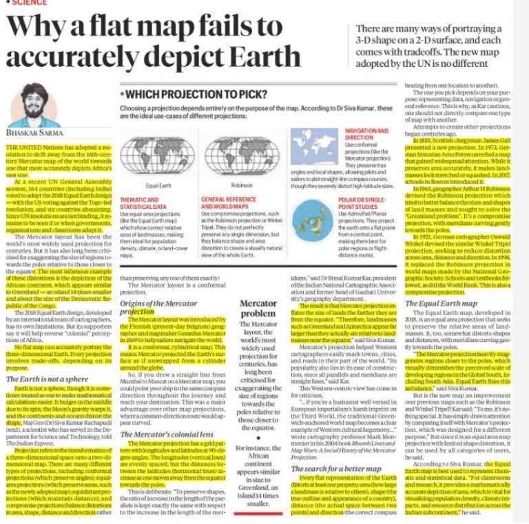
Choosing the Right Map Projection
Different purposes require different projections:
- Navigation and direction → Mercator-type projections
- Statistical and thematic data → Equal Earth projection
- General world maps → Robinson or Winkel Tripel projection
Importance in Geography
Understanding map projections is essential for:
- Cartography and GIS applications
- Climate studies
- Resource mapping
- Disaster management
- Spatial planning
Incorrect interpretation of maps can lead to misunderstanding of geographical realities.
Conclusion
No flat map can perfectly represent the Earth because converting a three-dimensional sphere into a two-dimensional surface always creates distortions. The appropriate map projection depends on the purpose of use. Selecting the right projection helps ensure accurate geographical analysis and better understanding of our planet.
Prelims MCQs
MCQ 1
Which of the statements given above are correct?
A) 1 and 2 only
B) 2 and 3 only
C) 1 and 3 only
D) 1, 2 and 3
Answer: A
Explanation:
Mercator projection is conformal and useful for navigation but distorts area near poles. Equal Earth projection maintains area accuracy. Robinson projection reduces distortion but does not eliminate it completely.
UPSC Mains Question
“Every map projection involves a trade-off between accuracy of area, shape and distance.” Explain with reference to major world map projections. (10 Marks)
Frequently Asked Questions (FAQs)
Why can’t a flat map accurately represent the Earth?
The Earth is a three-dimensional sphere, while maps are two-dimensional surfaces. Converting a curved surface into a flat map creates unavoidable distortions in area, shape, distance and direction.
What is a map projection?
A map projection is a mathematical method used to represent the Earth’s curved surface on a flat map. Different projections are designed for specific purposes such as navigation, area comparison or statistical analysis.
What is the Mercator Projection?
The Mercator Projection was developed by Gerardus Mercator in 1569. It preserves directions and angles, making it useful for navigation. However, it greatly exaggerates the size of regions near the poles.
Why does the Mercator Projection show Greenland larger than its actual size?
The Mercator Projection increases distortion as we move away from the equator. Since Greenland is located close to the Arctic region, it appears much larger than its actual land area.
What is the Equal Earth Projection used for?
The Equal Earth Projection preserves the relative areas of continents more accurately. It is useful for:
- Thematic maps
- Statistical studies
- Comparing sizes of countries and regions