Table of Contents
ToggleWetlands are transitional features occupying the space between deep aquatic systems and terrestrial environments. India’s unique topography, bounded by the Himalayas in the north and surrounded by a vast coastline, yields an extraordinary variety of these saturated ecosystems. From high-altitude alpine lakes to coastal mangroves, wetlands underpin the environmental stability of the subcontinent.
Definition of Wetlands
According to the Ramsar Convention, wetlands are defined as areas of marsh, fen, peatland, or water, whether natural or artificial, permanent or temporary, with water that is static or flowing, fresh, brackish, or salt, including areas of marine water the depth of which at low tide does not exceed six meters.
The domestic Wetlands (Conservation and Management) Rules, 2017 align closely with this, though they explicitly exclude river channels, paddy fields, and certain man-made water bodies from strict regulatory purview.
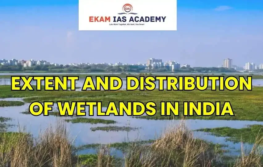
Extent of Wetlands in India
According to the scientific inventory compiled by the Space Applications Centre (ISRO), the total extent of wetlands in india is estimated to be around 15.26 million hectares, which accounts for approximately 4.63% of the country’s total geographical area.
Of the total wetland area, inland wetlands account for roughly 69%, coastal wetlands account for 27%, and other smaller wetlands make up the remaining share.
Distribution of Wetlands in India
The geographic distribution of wetlands in india is highly uneven and heavily governed by regional rainfall, drainage networks, and terrain:
- State-wise Distribution: Gujarat leads the nation, accounting for more than 22% of the total wetland area in India, primarily driven by its extensive coastline, salt pans, and mangroves. It is followed by Andhra Pradesh, Uttar Pradesh, and West Bengal.
- Inland vs. Coastal: Inland wetlands dominate the total area, characterized extensively by natural water bodies like oxbow lakes in the Indo-Gangetic plain and man-made reservoirs across the Peninsular plateau.
Types of Wetlands in India
As per the core indian wetlands notes, these systems are broadly divided into four major categories:
Inland Natural: Includes high-altitude lakes (e.g., Tso Moriri), oxbow lakes (chaurs and beels of Assam and Bihar), and seasonal waterlogged marshes.
Inland Man-made: Comprises vast irrigation reservoirs, tanks, and water-harvesting structures (e.g., Harike Barrage).
Coastal Natural: Includes mangroves (e.g., Sundarbans), coral reefs, estuaries, tidal mudflats, and lagoons (e.g., Chilika Lake).
Coastal Man-made: Includes aquaculture ponds and salt pans.
Major Wetland Regions in India
- The Himalayan Region: Home to pristine, glacial, and tectonic freshwater and saline lakes like Pangong Tso and Wular Lake.
- The Indo-Gangetic Plain: Characterized by massive alluvial floodplains containing numerous oxbow lakes and seasonal wetlands that act as vital flood-buffers.
- The Deccan Peninsula: Dominated by an intricate network of man-made tanks, stone-quarry reservoirs, and rain-fed pools.
- The Coastal Zone: Stretching across 7,500 km, hosting massive brackish water lagoons (Chilika, Pulicat) and dense deltaic mangrove systems.
Importance of Wetlands and Biodiversity
- Hydrological Regulators: Wetlands act as natural sponges, absorbing peak floodwaters and slowly releasing them, minimizing down-stream disasters.
- Groundwater Recharge: They slowly let water percolate downward, replenishing vital agricultural aquifers.
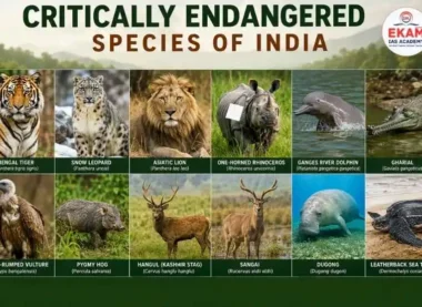
- Indian Wetlands Biodiversity: These areas support critically endangered fauna such as the Gharial, the Gangetic River Dolphin, the Sangai (Deer) of Manipur, and host millions of migratory waterbirds along the Central Asian Flyway.
Threats to Wetlands in India
- Encroachment and Urbanization: Unplanned real estate development has systematically converted urban wetlands into concrete zones, leading to severe urban flooding (e.g., Bengaluru and Chennai).
- Agricultural Runoff and Eutrophication: Excess fertilizers lead to algal blooms that deplete dissolved oxygen, transforming thriving lakes into biological dead zones.
- Industrial Pollution: Uncontrolled discharge of untreated toxic effluents and heavy domestic sewage.
Government Initiatives and Conservation Measures
- Wetlands (Conservation and Management) Rules, 2017: This framework decentralizes monitoring by mandating the creation of State Wetland Authorities (SWAs) for localized regulation.
- Ramsar Alignment: India has actively designated 85 Ramsar Sites as Wetlands of International Importance, securing a robust conservation framework.
- Amrit Dharohar Scheme: Launched to actively promote the conservation value of Ramsar sites, optimizing eco-tourism and generating sustainable incomes for local communities.
Conclusion
For the wetlands in india UPSC syllabus, understanding these ecosystems highlights the intersection of hydrology, policy, and climate resilience. Safeguarding India’s vast wetland matrix requires moving away from viewing them as mere “wastelands” and integrating them into formal urban and rural land-use planning. Active execution of local laws alongside public stewardship remains the most effective path toward preservation.
UPSC Prelims: PYQs & Practice Questions
Previous Year Questions (Prelims)
Q: With reference to the wetlands of India, consider the following statements: (UPSC CSE Prelims 2012)
1. The country’s total wetland area is nearly the same as the total area of the state of Gujarat.
2. In India, the total area under inland wetlands is greater than that under coastal wetlands.
Select the correct answer:
(a) 1 only
(b) 2 only
(c) Both 1 and 2
(d) Neither 1 nor 2
Answer: (b) 2 only
Explanation:
Statement 1 is incorrect because the total extent of wetlands in India is approximately
15.26 million hectares (~4.63% of the country’s landmass), which is not equal to the total geographical area of Gujarat.
Statement 2 is correct because inland wetlands such as rivers, lakes, reservoirs, and ponds account for nearly
69% of India’s wetlands, whereas coastal wetlands account for around 27%.
Q: “If rainforests and tropical forests are the lungs of the Earth, then surely wetlands function as its kidneys.” Which one of the following functions of wetlands best reflects the above statement? (UPSC CSE Prelims 2022)
(a) The water cycle in wetlands involves surface runoff, subsoil percolation and evaporation.
(b) Algae form the nutrient base upon which fish, crustaceans, molluscs, birds, reptiles and mammals thrive.
(c) Wetlands play a vital role in maintaining sedimentation balance and soil stabilization.
(d) Aquatic plants absorb heavy metals and excess nutrients.
Answer: (d) Aquatic plants absorb heavy metals and excess nutrients
Explanation:
Wetlands are called the “Kidneys of the Earth” because they naturally
filter pollutants from water. Aquatic vegetation, microbes, and sediments trap sediments, absorb
heavy metals, and remove excess nitrates and phosphates, thereby purifying water before it enters rivers, lakes, or underground aquifers.
Practice Questions
Q: In the context of the spatial distribution of wetlands in India, consider the following statements:
1. Among all states and union territories, Tamil Nadu holds the highest percentage share of wetland area relative to its own geographic territory.
2. In terms of absolute total wetland area, coastal natural wetlands cover a larger surface footprint than inland natural wetlands across India.
3. The state of Gujarat contains more than one-fifth of the entire nation’s cumulative wetland area.
Select the correct answer:
(a) 1 and 2 only
(b) 3 only
(c) 1 and 3 only
(d) 2 and 3 only
Answer: (b) 3 only
Explanation:
Statement 1 is incorrect because Gujarat, not Tamil Nadu, has the highest wetland share due to its vast salt pans, mudflats, and creeks.
Statement 2 is incorrect because inland natural wetlands occupy a much larger area than coastal wetlands in India.
Statement 3 is correct as Gujarat contributes nearly 22–23% of India’s total wetland area.
Q: Under the Wetlands (Conservation and Management) Rules, 2017, which of the following categories of water bodies are explicitly excluded from the regulatory definition of a wetland in India?
1. Mangrove ecosystems and salt marshes
2. Paddy fields and rice cultivation zones
3. River channels and main streams
4. Man-made irrigation tanks and village ponds
Select the correct answer using the code given below:
(a) 1 and 4 only
(b) 2 and 3 only
(c) 2, 3 and 4 only
(d) 1, 2, 3 and 4
Answer: (b) 2 and 3 only
Explanation:
The Wetlands Rules, 2017 exclude river channels, flowing streams, and paddy fields from the legal definition of wetlands to avoid governance overlap.
Mangroves continue to receive protection under both the CRZ Rules and Wetland Rules, while many static artificial wetlands may still fall within regulatory protection.
UPSC Mains – Previous Year & Practice Questions
Mains Previous Year Questions
Question: What is a wetland? Explain the Ramsar concept of “wise use” in the context of wetland conservation in India. (Mains 2018)
(Evaluates baseline understanding of wetland types and sustainable utilization principles)
Question: Discuss the causes and consequences of urban flooding in India, with specific reference to major cities. (Mains 2020)
(Highlights how reclamation of urban wetlands causes systemic failures in cities like Bengaluru and Chennai)
Question: Enumerate the indirect services provided by an ecosystem. How do wetlands act as “Earth’s Kidneys”? (Mains 2014)
Question: Identify the main causes of the loss of biodiversity in India. (Mains 2023)
(Points to unscientific conversion of natural wetlands into commercial and urban land use)
Question: Coastal regions of India are prone to cyclones. Discuss the role of mangroves in reducing the impact of such disasters. (Mains 2019)
(Focuses on the ecological protection provided by coastal wetland ecosystems)
Mains Practice Questions
[10 Marks | 150 Words]
Question: Account for the highly uneven spatial distribution of wetlands between the East Coast and the West Coast of mainland India.
[15 Marks | 250 Words]
Question: The legal exclusion of river channels and agricultural paddy fields from the Wetlands (Conservation and Management) Rules, 2017 creates a regulatory blind spot. Critically analyze.
[15 Marks | 250 Words]
Question: How does the degradation of natural inland wetlands compound the dual crisis of water scarcity and urban heat islands in rapidly developing peninsular India?


Extent and Distribution of Wetlands in India-FAQs
Which state has the maximum absolute area under wetlands in India?
Gujarat leads the country by a wide margin, accounting for over 22% of the nation’s total wetland area. This dominance is primarily driven by its unique geography, which features extensive intertidal mudflats, salt pans, estuaries, and the marshy tracts of the Rann of Kutch.
What is the primary difference in wetland types between Northern and Southern India?
Northern and North-Eastern India are dominated by Inland Natural wetlands, such as high-altitude tectonic/glacial lakes (e.g., Wular, Pangong Tso) and massive oxbow lakes (beels and chaurs) formed by the meandering Indus, Ganga, and Brahmaputra river systems. In contrast, Southern Peninsular India is dominated by Inland Man-made wetlands, specifically a dense historical matrix of irrigation tanks, reservoirs, and community-engineered bunds.
How many Ramsar sites are there currently in India, and which state has the highest count?
India has significantly expanded its network to 98 Ramsar sites (as of early 2026, with recent additions like Chhari-Dhand in Gujarat and Patna Bird Sanctuary in UP). Tamil Nadu holds the highest number of individual designated Ramsar sites (20) in the country, showcasing remarkable progress in securing international recognition for its avian and coastal habitats.
Why does the ISRO Space Applications Centre map wetlands smaller than 2.25 hectares if they aren't regulated?
While small wetlands (<2.25 hectares) are often left out of rigid legal notification frameworks under the 2017 Rules due to administrative constraints, they are ecologically mapped because they represent crucial satellite pockets for local biodiversity. They act as stepping stones for migratory birds, fulfill micro-hydrological recharge needs for rural agriculture, and cumulatively prevent rapid drops in local water tables.
What is the 'Amrit Dharohar' scheme and how does it relate to wetlands?
Launched to enhance the “wise use” principle of the Ramsar Convention, the Amrit Dharohar scheme focuses on generating tangible economic livelihoods for local communities directly through the sustainable conservation of Ramsar sites. It achieves this by transforming these areas into hubs for regulated eco-tourism, biodiversity conservation, and community-led green jobs, changing the local narrative from viewing wetlands as wasted land to recognizing them as natural capital assets.